
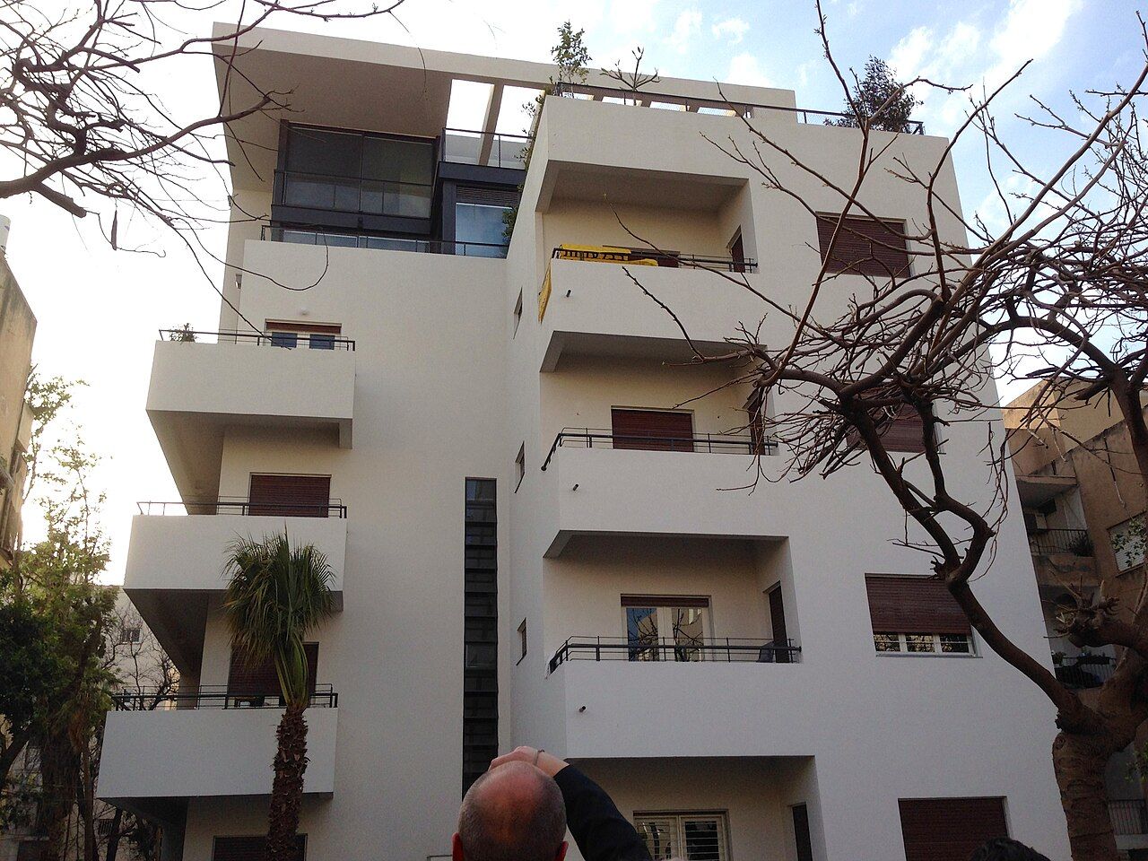
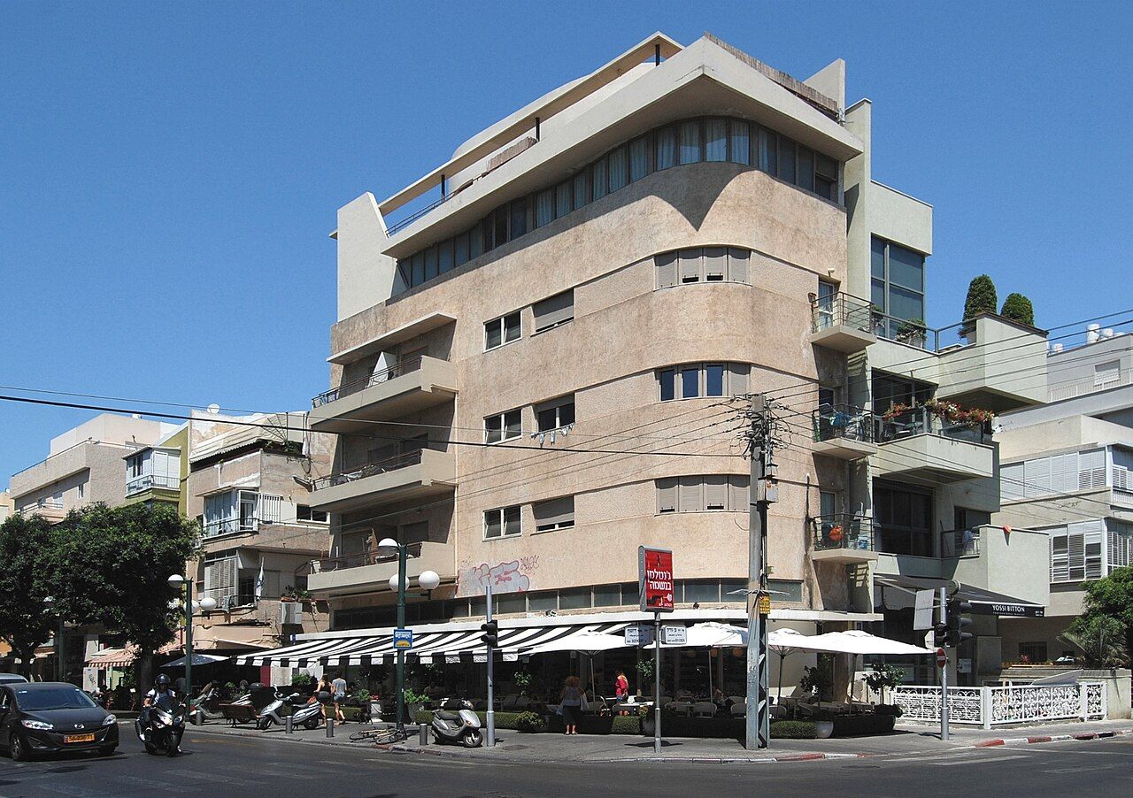
Tel Aviv was founded in 1909 on the sand dunes north of Jaffa, and grew fast in the 1930s as immigrants arrived from Europe. Many of the architects who designed the new city had trained in Germany, France and elsewhere in Europe, some at the Bauhaus school, and they built in the modern International Style: white or pale plaster, flat roofs, long horizontal balconies and strips of windows. The result is the White City, a large area of central Tel Aviv with around four thousand buildings in this style, added to UNESCO's World Heritage list in 2003.
Unlike most heritage sites, the White City is not fenced or ticketed. It is simply the place where people live, shop and drink coffee, and a morning walk lets you read its architecture as you go.
What to look for
The buildings were adapted to the local climate. Balconies are deep and shaded, often curving around corners to catch the sea breeze. Narrow slit windows light stairwells, sometimes stacked vertically in a pattern known locally as a thermometer window. Many buildings stand on pilotis, slim columns that lift them above the ground and let air move beneath. Flat roofs were used as shared terraces.
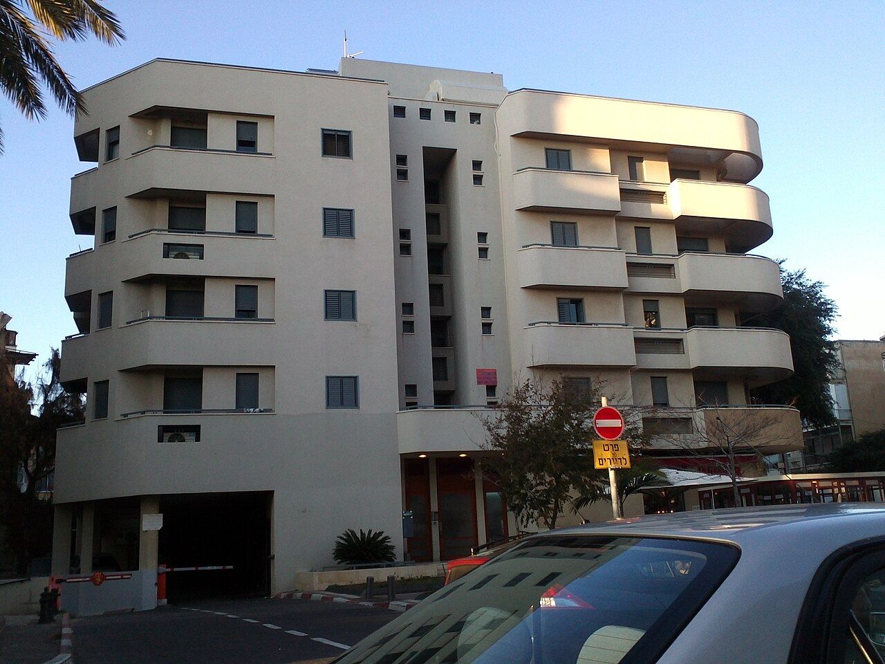
The city plan itself, drawn up in the 1920s by the Scottish planner Patrick Geddes, gave the area its rhythm of main streets, quieter residential streets and small green squares. Look up as you walk: much of the detail sits on the upper floors, and some buildings have been carefully restored while others wait their turn under peeling plaster.
Rothschild Boulevard
Start at the southern end of Rothschild Boulevard, one of the city's first streets. A broad central strip runs down the middle, shaded by large trees, with benches, kiosks and a bike lane, while the buildings on either side span the city's history from early eclectic villas to clean-lined 1930s blocks. Near the southern end stands Independence Hall, where the State of Israel's Declaration of Independence was read in 1948.
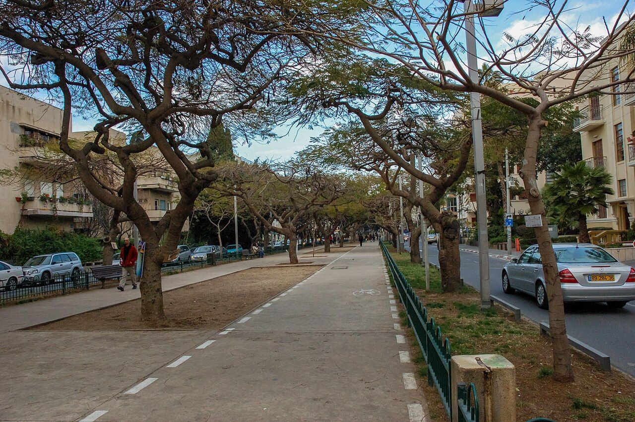
Walk north along the shaded strip, crossing side streets to look at facades. The morning light on the white walls is softer than at midday, and the boulevard is quieter before the cafes fill. At the northern end, the Habima Theatre and its plaza mark the edge of the cultural district.
On the way, the side streets to the east and west are worth short loops. Some of the most carefully restored buildings stand a few doors off the boulevard, where traffic is lighter and you can step back far enough to see a whole facade. Weekday mornings are calmest; on Friday the boulevard fills with families, dogs and cyclists.
 Another day · CoastUp the hill to the old port
Bialik Street and Dizengoff
A short detour leads to Bialik Street, a quiet lane named after the poet Hayim Nahman Bialik, whose house stands near its end. The street finishes at a small square in front of the old town hall, now a museum of the city's history. Several buildings here show the transition from earlier styles to the International Style.
Further north, Dizengoff Street was the city's fashionable shopping and cafe street from the 1930s, and it still has a busy, lived-in feel. Its circular square, Dizengoff Square, was surrounded by uniform curved buildings in the 1930s design. The square was raised above traffic in the 1970s and returned to street level in 2018, restoring the original layout around a central fountain.
Many of the most admired buildings are private homes, so admire them from the street, and keep your voice down in residential courtyards.
Reading a street
Once you have the eye for it, any street in the area becomes a lesson. Compare corners, where architects liked to round the walls and wrap balconies around the curve, with the plainer middle of the block. Look for the original thin steel window frames, the small entrance canopies over doors, and the lettering of street numbers set in the plaster. Notice too how later additions have changed many buildings: enclosed balconies, air-conditioning units, extra floors set back on the roof. The city's conservation rules allow some of these additions in return for restoring the original facade, which is why you will see gleaming restorations beside tired neighbours on the same street.
The quieter streets between Rothschild Boulevard and Dizengoff Street, and those around the small squares, hold many of the best examples. Wander rather than follow a fixed line. A good map of the area, or a self-guided walking route from the city's tourist information points, helps you find specific buildings.
Down to the promenade
From Dizengoff, any of the streets heading west will bring you to the sea within fifteen minutes. The beach promenade, known as the tayelet, runs for several kilometres along the shore, with public beaches, lifeguard stations, outdoor gyms and benches. In the late afternoon it fills with joggers, cyclists, families and people watching the sun go down.
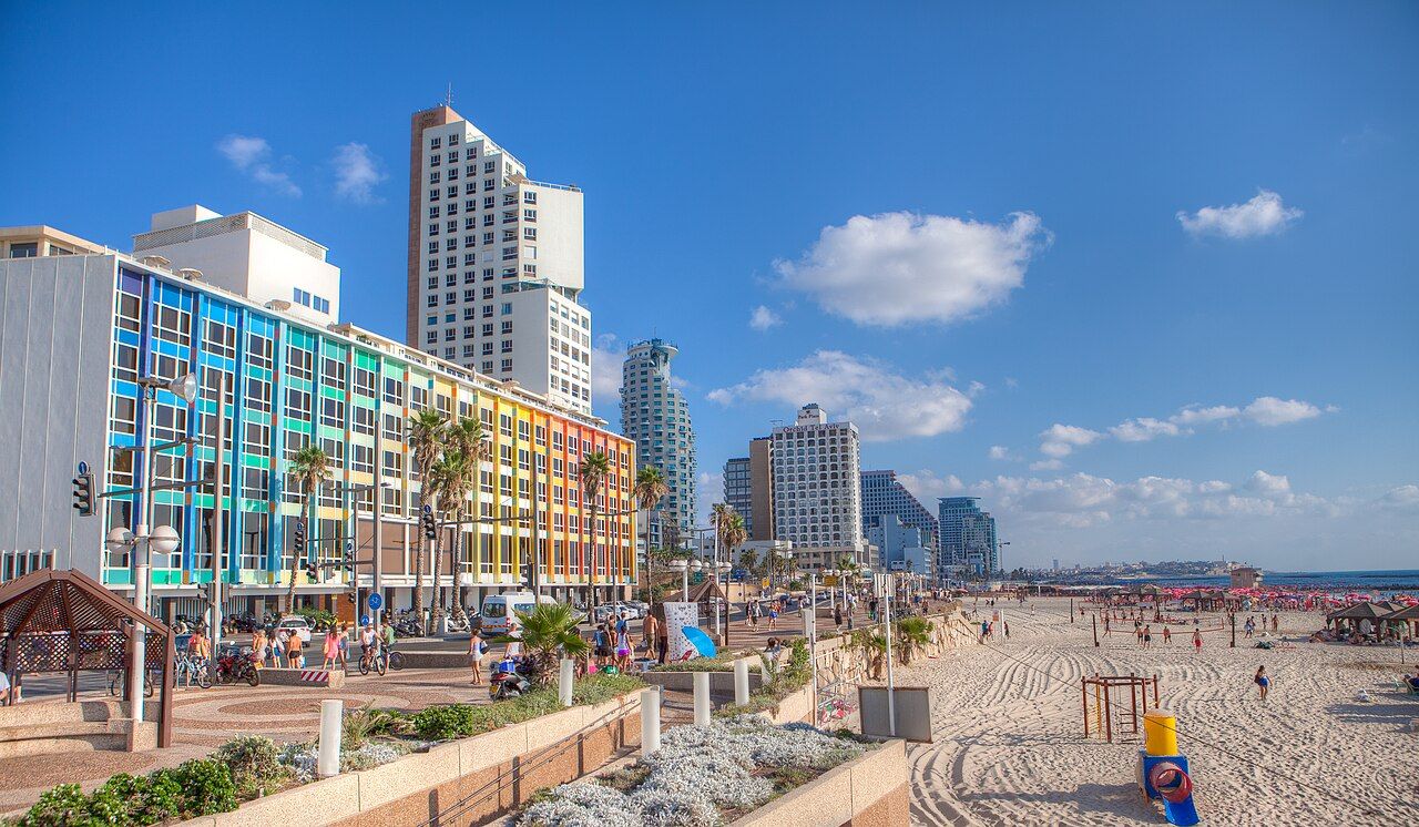
Swim only at beaches with lifeguards on duty, and pay attention to the flags; currents along this coast can be strong. Some beaches are set aside for separate bathing on certain days. Shade is scarce in the midday sun, so many locals come early or late.
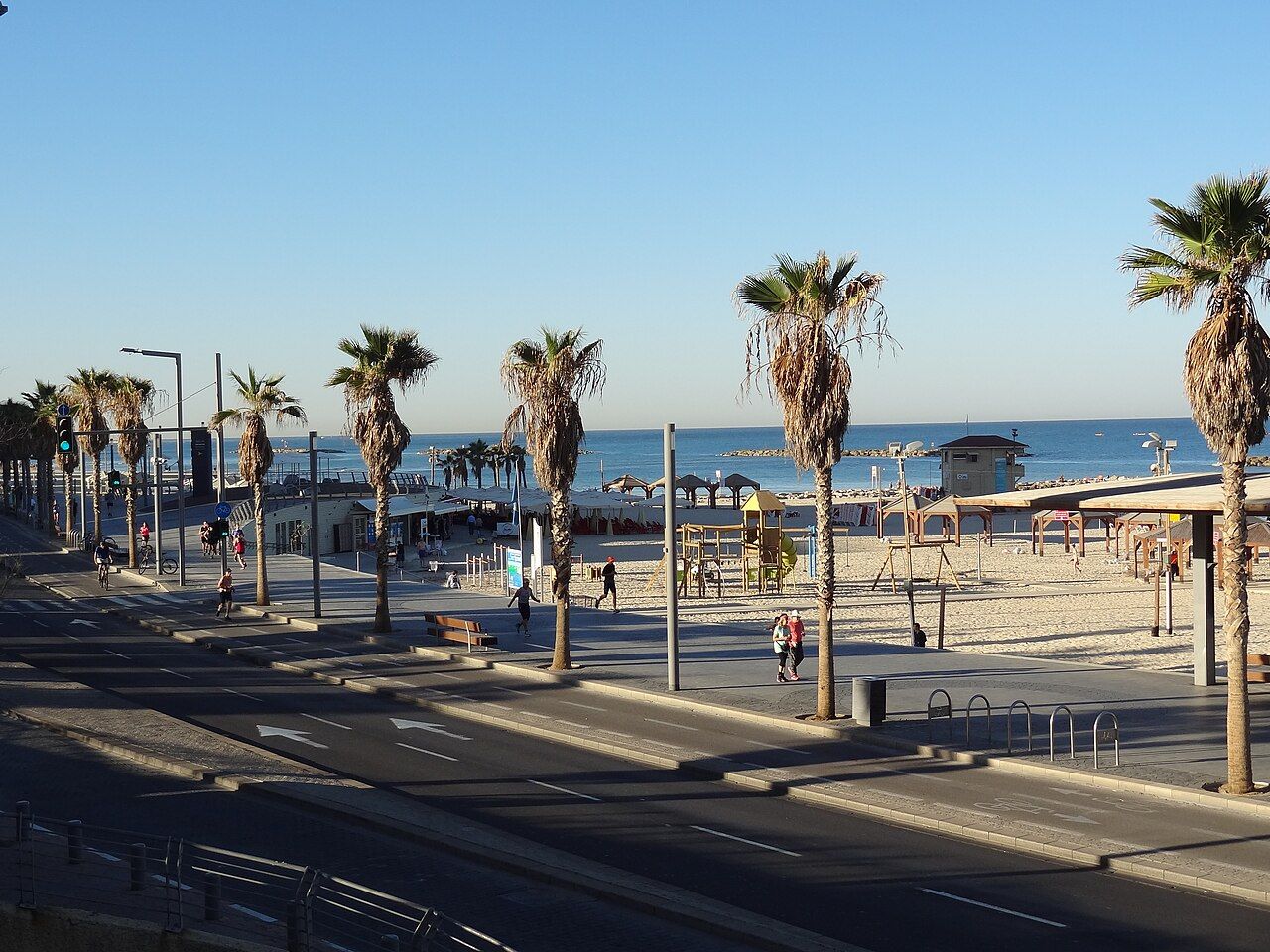
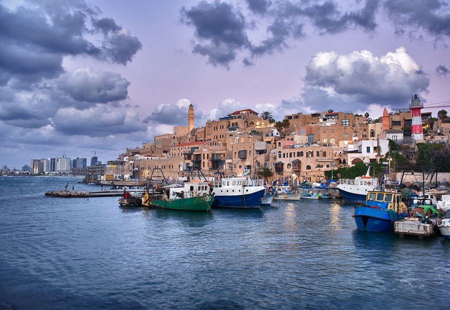
Walking south, the promenade leads past the marina and on to the old port of Jaffa, about an hour away on foot. The guide to Old Jaffa and its port picks up from there. To the north, the path continues past the Tel Aviv Port area and toward the Yarkon River.
Walking south, the promenade leads past the marina and on to the old port of Jaffa, about an hour away on foot.
Bikes, buses and heat
Tel Aviv is flat and well suited to cycling, with a growing network of bike lanes. The city runs a public bike share scheme with docking stations across the centre, as well as electric scooters available to rent. Rules on helmets, lanes and age limits apply; check the current terms before you ride, and watch for pedestrians on shared paths.
Some of the best-known International Style buildings line the streets around Rothschild Boulevard, so a bike lets you cover more of them in a morning and still have time for the sea. Lock up at a docking station before you explore on foot, and return the bike on time to avoid extra charges.
The city is humid from June to September, and the midday sun is fierce even in spring. Carry water, wear a hat, and plan the boulevards for the morning and the beach for later. Trains and buses link Tel Aviv with the rest of the country, though most stop on Shabbat; the guide to getting around Israel explains the options. Check your own government's current travel advice before you go.